I am pretty regularly asked by architects and engineers to find topographic data for some random spot in the world. This is not a particularly hard task for a GIS-minded person. But there are often two additional complexities in delivering these.
- They need contour lines at a specific interval
- They need the data to be in a CAD format format instead of a GIS format.
Major caveat here: I have never worked in CAD and know very little about it, but using normal, everyday GIS tools, you can convert existing topographic data over to something that should work.
This series of posts will go through how you can access, process, and export topographic data for your CAD project. I will outline the process in both ArcGIS and qGIS.
First, is accessing the topographic data. The sources for these can obviously vary quite a lot. Here are a few key ones that I use regularly. Most require registration, but are free.
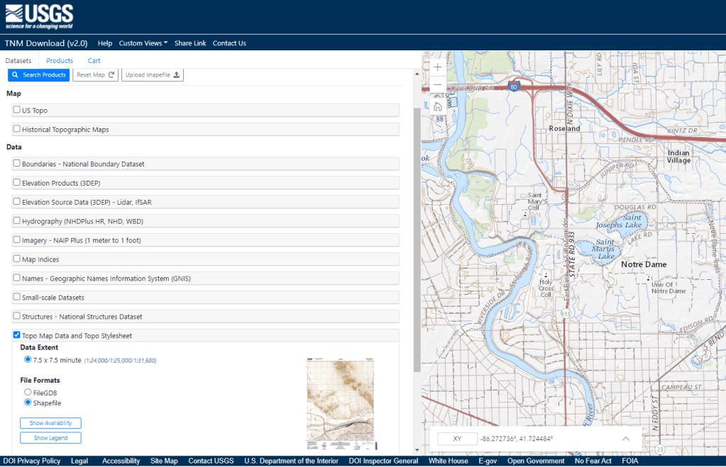
- For the US: All of the basemap data for the USGS Contour Maps (also called Quad Sheets) can be accessed in ready-to-go shapefile format through the National Map Downloader. Once there, you can download individual raster maps, the source data, imagery, structures and the contour data for the maps.
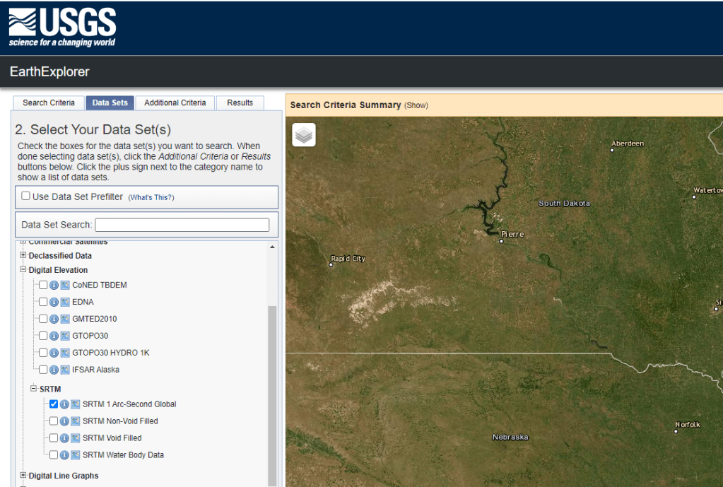
- SRTM Data: The Shuttle Radar Topography Mission from the late 90’s is a good way to get larger scale data. It is 90 meter resolution, so not fantastic, but can work for bigger areas. It can be downloaded from the USGS Earth Explorer. The SRTM data is in the Digital Elevation Section -> SRTM and the 1 Arc-Second Global is the best one for these sorts of projects
- ASTER gDEM v3: My favorite source for raster topo data in a worldwide context comes from the ASTER satellite. The most recent version is accessible through NASA’s EarthData platform (which requires registration). The interface is a little complex, but basically, you search for ASTER gDEM, use the spatial filter (
 ) to find a particular location, and then click on the gDEM entry to download individual tiles. You want the one that ends in _dem.tif

So, now you should have either a shapefile downloaded (from the NationalMap) or a raster Digital Elevation Model from the SRTM or ASTER projects. Either way, the following posts will demonstrate how to process that download in both ArcGIS and qGIS.

2 thoughts on “Finding topographic data for CAD projects (1/3)”